For more information regarding Confederation Trail see the following websites:
http://www.tourismpei.com/pei-confederation-trail
http://www.tourismpei.com/pei-cycling
http://www.tripadvisor.ca/Attraction_Review-g155022-d265234-Reviews-Confederation_Trail-Prince_Edward_Island.html
Above: new pavement on Centerline Road - this photo is taken going east - the Confederation Trail is just ahead as the road straightens.
Confederation Trail, looking south - this takes you towards Rte. 2 in Alma and further to Alberton.
Confederation Trail, looking north - this takes you towards St. Louis and to the end at Tignish.
Above: looking north down Confederation Trail.
Above: Confederation Trail, looking north, a short distance in on the trail from Centerline Road - on the far left you can see the house and barn of Jeffery Homestead. Below: Jeffery Homestead as seen from Confederation Trail - using zoom lens.
Below: looking back towards Centerline Road - its just ahead.
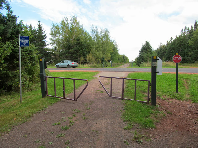
Below: Entry gates to Confederation Trail.
Below info cf. http://www.tourismpei.com/confederation-trail/tignish-to-elmira
Main Trail (Tignish to Elmira) - Main Trail (cumulative distance)
| Tignish to Elmira | KM |
| Tignish | 0 |
| St. Louis | 11.1 |
| Alma | 14.6 |
| Alberton | 21.1 |
| Elmsdale | 26.8 |
| Bloomfield | 35.5 |
| O'Leary | 44.8 |
| Portage | 59.1 |
| Ellerslie | 71.9 |
| Richmond | 82.9 |
| Wellington | 90.7 |
| Summerside (waterfront) | 109.3 |
| Kensington | 122.7 |
| Freetown | 131.1 |
| Emerald | 136.8 |
| Fredericton | 147.4 |
| Hunter River | 154.5 |
| Milton | 170.8 |
| Royalty Junction | 176.7 |
| York | 182.9 |
| Tracadie | 195.3 |
| Mount Stewart | 204.0 |
| Morell | 219.1 |
| St. Peters | 230.5 |
| Selkirk | 242.1 |
| Bear River | 248.9 |
| Harmony Junction | 257.6 |
| Elmira | 273.4 |


